Hiking Stowe: Five immersions into the quiet beauty
Updated on September 23rd, 2020
Five Hiking Trails perfect for Stowe, Vermont Fall Foliage Rated the best in the U.S. by Trip Advisor
Leisurely walks in the neighborhoods of Boston, Long Island, Newark or Washington D.C., often provide an abundance of man-made beauty seasoned with splashes of nature.
In Vermont with its 300,000 acres of state-owned forests, 53,000 of which are in Stowe, a casual walk is completely different. Outdoor strolls in Stowe are a gumbo of wild blackberries, clear spring water, plunge pools at the base of falls, fresh aromas from fir and cedar, calming vistas of tree covered mountains, sunlight stepping stones along wooded paths and relaxing breezes nestling among overhead branches, needles and leaves. You are alone yet surrounded, relaxed yet invigorated. You are in the unspoiled forests of Stowe.
Interested?
 Soon it will be leaf season and Vermont has been declared the Number One destination for fall foliage in the U.S. (Trip Advisor). Here are five journeys that are good for the soul no matter what the weather, but during this season these become emotionally serving; witness to unexpected celebrations of life. Enjoy as the Lord in paints each leaf while we sleep at night. Bring your camera.
As you take to the roads and paths, keep these thoughts in mind from the Get To Know Stowe book:
- Stowe is home to two mountain ranges; Worcester range to the east, and the green Mountains run to the north and are part of the Mt. Mansfield State Forest.
- Generally allow 30 minutes for each mile plus an additional 30 minutes for every 1,000 feet gained in elevation.
- Bring plenty of water; avoid drinking backcountry water.
- High-energy snacks are a good idea (granola bars, trail mix, chocolate)
- Pack a map, compass, first-aid kit, flashlight and pocket-knife. Whistles can be helpful. Take a shell, hat, & gloves no matter what the season.
- Sign-in/Sign-out at any trail-head registers; stay on marked trails.
- Don’t travel alone, especially on more difficult journeys.
Hiking the Ranch Brook & Burt Trail
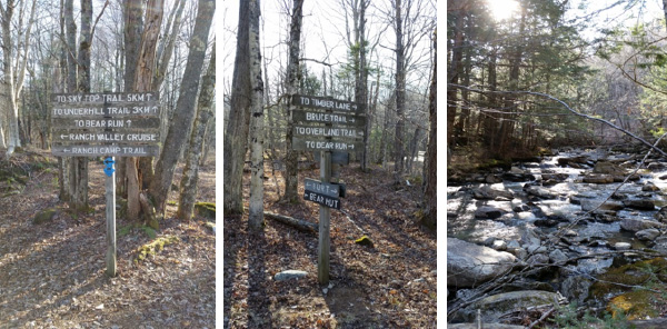
Just past the right-hand entrance to the North Brook road along Rt. 108, before you cross a small bridge, you’ll see a quick left turn onto an unpaved road — the Ranch Brook road. Park if there’s space and immediately start your walk down the right hand fork which is a slightly rutted road. Soon it flattens out becoming an old timber-hauling road, and further down it offers another place to park your car. You are now in the Ranch Valley and its extensive system of well-marked trails with the beautiful Ranch brook running parallel on your left. In the winter Nordic skiers or snowshoers may require a pass on many of these trails from the Stowe mountain resort’s Cross Country Ski Center. In the summer no charges are necessary.
You’re on the Burt Trail – which for the moment is a class-4 road ––a gravel surface — until it reaches the junction of Ranch Camp, Bruce Trail, and the Bear Run. Horses and bikes will need to turn around since the remaining trails are no longer graveled.
This historic area gave birth to skiing in Stowe and is part of the Mansfield state Forest. Travel for another mile past the Adams Camp and later find the remains of the first lumber camp used when creating the first of the stowe ski runs back in 1933 by the CCC which stood from 1932 to 1950. Craig Burt offered his lumber camp to Stowe’s first overnight ski guests. Another short distance and you have reached the junction that offers three choices for the next phase of your journey:
- Left is the Ranch Camp Trail which heads towards the Trapp Family Lodge trail system.
- The Burt trail in the center continues and is the least hilly.
- However, the right hand Bruce trail ascends steeply up the Ranch Valley and its degree of difficulty becomes much higher. Eventually Bruce takes you to the original ski trail that was cut by the Civilian Conservation Corps in 1933, part of FDR’s New Deal program – the first ski trail in Stowe. From here you backtrack to Timber Lane that heads towards the Mt. Mansfield Ski Touring area. Take one of the Cross cut trails south from Timber Lane back to the Ranch Brook road to return to the beginning of your journey. These are trails that reveal history and beauty. Total distance will be about six miles.
Hiking Sterling Pond
While you are casually driving through Smuggler’s Notch on your way over the mountain from Stowe, look for a parking lot on the left hand side of the road near the top of the road. Park. Across the street find a trial heading up that begins a bit rocky and steep. While you are panting a bit, enjoy the smell of fresh pine and evergreens.
After about a mile the Sterling Pond Trail is joined by the Long Trail. Turn left and head down to the pond. Catch your breath, sit on a rock and enjoy the view of Vermont’s highest elevation trout pond. Catch some fish, relax, and enjoy the quiet. There is a shelter near the lake if needed. Ready to move on? Stay on the Long Trail going north for about .3 miles and look for a short spur trail to the top of Smuggler’s Notch Ski Resort and enjoy the views across to Mt. Mansfield – you’re now at 3,000 feet. Backtrack along the spur to the Long Trail north to the shelter near the chairlift where you will take a right onto Elephant’s Head Trail that continues around the pond. When you’ve gone about ¾ of a mile look for another intersection with the Long Trail and head downhill (turn right). This takes you to the Sterling Pond Trail – where you will turn left back to the parking area.
Total pond circumference is about 1.4 miles clockwise around the pond.
Total distance is 2.8 miles plus an additional easy 1.4 mile loop around the pond.
Elevation gain is 1,000 feet.
Time is 2.5 hours.
Difficulty is rated Moderate by the Green Mountain Club.
Hiking at Lake Mansfield Trout Club
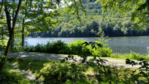
There are many signs that say don’t enter this private refuge and enormously beautiful spot, however, continue on your journey. The Trout Club is intensely private, however, management’s respect for the beauty of Vermont and their location on Lake Mansfield permits outsiders like you and I to hike in the woods that surrounds the lake. Mansfield Lake is 39 acres surrounded by hills – a stunning setting. The lake, of course, is annually stocked with Trout. The Lodge was originally built in 1899 and the Trout Club seems to have its own unique culture.
From Waterbury heading north towards Stowe, take Rt. 100 and turn left on Moscow Road. Continue on Moscow past the Barrows Road cutoff until you find Nebraska Valley Road on the right (just past the intersection with the Trapp Hill road on the right.) It’s going to be about four miles until you reach the Lake Mansfield Trout Club.
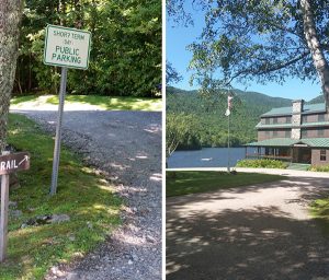
There is a clearly designated area to park close enough to the Lodge to capture the picture on the left. There is also a clearly marked entrance to the one hiking trail. The first half mile runs parallel to Lake Mansfield and occasionally opens onto the lake. Once you have passed the lake you continue on the Lake Mansfield Trail heading north-north-west for more than a mile to reach Taylor Lodge. Just before you reach the lodge you will find a small, lovely waterfall.
The trail is relatively narrow but despite tree roots and the usual array of sleeping rocks it is entirely navigable. The surroundings are classic, unspoiled Vermont.
The lodge in is at the intersection of the Lake Mansfield Trail, the Long Trail, and the Clara Bow Trail. Total elevation gain is about 500 – 600 feet; manageable since it has over a mile to work with. Taylor Lodge is in the midst of the Mount Mansfield State forest, and the only way home is to backtrack the way you came.
Hiking at Little River State Park
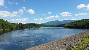
In the early 1800s, pioneers cleared fields, rocks, and stumps in the Ricker Basin and Cotton Brook. A settlement of 50 or so families once lived in this area. For about 130 years this was a thriving community of farms, sawmills, churches, schools, creameries and taverns. Gradually, the demands of the land and weather forced younger generations to abandon the farms. On November 3-4, 1927, torrential rains caused massive flooding, property destruction and loss of life throughout Vermont. A second flood in 1934 inundated Waterbury; this spurred the construction of Waterbury Dam. Between 1935 and 1938 the Civilian Conservation Corps (CCC), in cooperation with the U.S. Army Corps of Engineers, constructed the 180 acre Waterbury Reservoir (pictured below) which runs adjacent to the Little River State Park. The CCC camp here was a fully operating, thriving community with more than 80 buildings, and housing 2,000 men at its peak.
Today, cemeteries, sawmill remains, old town roads, bridges and many cellar holes can still be seen as evidence of past communities. Hiking trails abound and each finds another piece of the history – both a trip through the beauty of Vermont and its history. There are a total of 26 miles of different trails within the Little River State Park.
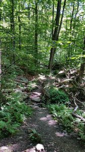
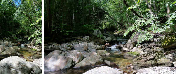
These shots were taken along the Stevenson Brook Trail which runs for about 2.5 miles. The Stevenson Brook runs down the eastern slope of Ricker Mountain and takes thousands of gallons of snowmelt in Spring resulting in currents strong enough to move all but the largest boulders.
Hiking the Hell Brook Trail
The Hell Brook trail (also called the Mansfield Trail) is a fun and challenging route to ‘The Chin’ of Mount Mansfield (The Summit). This is the shortest and steepest but also most technically difficult route to the summit. It is generally considered one of the most challenging hikes in the state. The trail is mostly large rocks and is usually wet. This route is considerably less busy than the popular Long Trail, which also makes it nice.
From Stowe village take Rt 108 north 8.4 miles. On the left side of the road look for the brown “Long Trail” signs and the 2″X6″ blue blazes marking the Hel Brook trail. Park in the Big Spring parking area.
Right from the start you experience a daunting grade that will keep you breathing a bit faster as you begin to climb. It is not unusual to find wet conditions – mud and running water – so waterproof footware is essential. Moisture makes climbing more difficult, since Hell Brook is known for challenging rock climbs that require using all parts of your body. Expect to show some badges of courage (scratches, gashes, etc.) from this climb. The pace of difficulty is unrelenting with hand-over-foot scrambles, and especially when you encounter alpine streams raining down on you. The last climb to the chin is difficult and technical. Lots of rocks and many opportunities such that you are near exhaustion – and as a result — heightened danger. It’s not called “Hell Brook” for nothing! Views are impressive from the top, but wind and lower temps (10 to 15 degrees) are another danger. Bring an extra cover to ward off hypothermia.
The Green Mountain Club does NOT recommend descending back the way you came. Too wet and too dangerous. Hell Brook ends at the intersection with the Long Trail and that is the way down. When you reach Rt 108, head north until you reach the Big Spring parking area (this will be the easiest portion of your hike).
Total distance = 3.6 miles
Time for the climb = 4 hours
Climb = 2590 feet – the steepest vertical climb on the Long Trail.
Difficulty = Very hard. Do not undertake this climb alone.
Looking for other adventures in Stowe Vermont?
Come…experience unexpected celebrations of life together. See more…

“Make sure to drive through Smugglers Notch State Park!”
Todd and Kristie were fabulous host making sure to inform us where to eat, shop and find all the covered bridges in the area. They also pointed out great hiking trails in the area and made sure to mention to drive through Smugglers Notch State Park. So glad they did.
LMUM, Oklahoma
Tags: fall, fall foliage, Fall in Stowe VT, Get Outdoors, Hiking, Stowe


